Thirteen Acres is supported by our readers. When you buy through links on our site, we may earn an affiliate commission. As an Amazon Associate, we earn from qualifying purchases.
There are many things you can take advantage of when you're buying property. One of the most indespensible resources we found and then made extensive use of was the Geographic Information System (GIS). We talked a bit about soil in our post about looking for a lot, but we'll go into some more detail in this post about how the GIS helped us eliminate properties (and thus, saved us time) or put properties on the top of our list before we ever went out to see them.
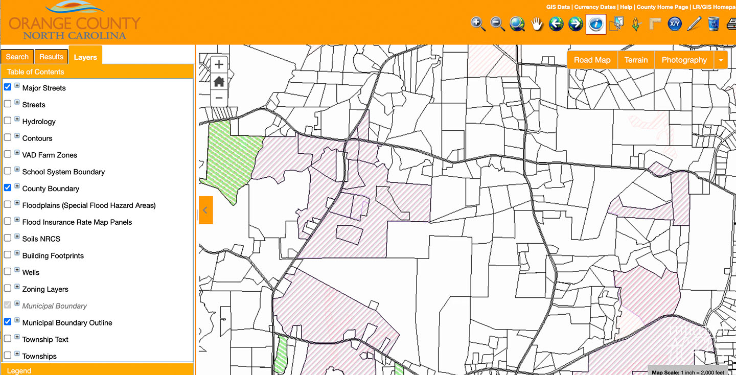
Depending on the areas where you're looking for land, your county may expose a GIS for public use. A simple Google search of your county name and state followed by "GIS" should help you locate it. Every county we looked in had public access to the GIS for the county, and while some had more data than others, they were all very helpful to our search.
So what is a GIS?
A geographic information system is a computer system for capturing, storing, checking, and displaying data related to positions on Earth’s surface. By relating seemingly unrelated data, GIS can help individuals and organizations better understand spatial patterns and relationships.
- National Geographic
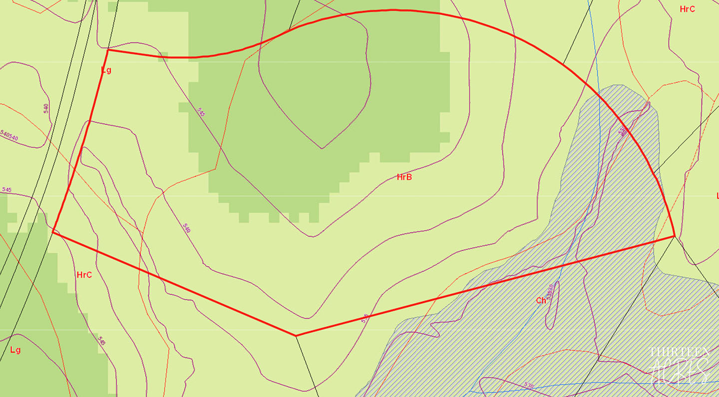
The GIS is made up of layers and you can apply layer upon layer to find the information that you need. For example, in the photo above, you can see the contour layer outlined by purple lines (height above sea level) which helps you determine the highest points on the property, and the soil type outlined by red lines. Due to our need for a septic system, we were very intent on finding soil that could support a 4-bedroom septic system. While we'd still recommend getting a soil engineer and having a soil test done to confirm soils, we found that the GIS was able to give us a decent amount of information on the soil on each piece of land we looked at.
Based on the photo above, we could tell that our property was primarily soil type HrB and if we wanted to place our house at the highest point of the property, we'd be right in the middle of the HrB soil.
These lines and layers can get overwhelming, which is why the GIS allows you to add and remove layers as needed. If you're only interested in soil, you can turn off all other layers and see something like the image below.
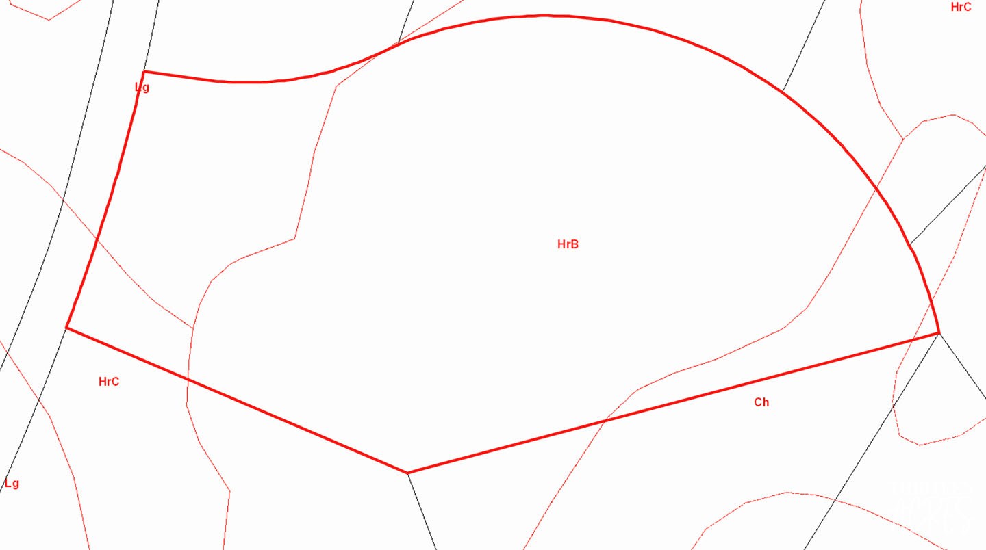
That's a little cleaner, but what does HrB mean? Well, as we learned, that's a question easier asked than answered. Soil types are pretty diverse across the state, let alone across the country. When we were looking at land, we started in one county and just as I was getting a hang of what soils were in the county, we decided to start looking in a different area which had totally different soils.
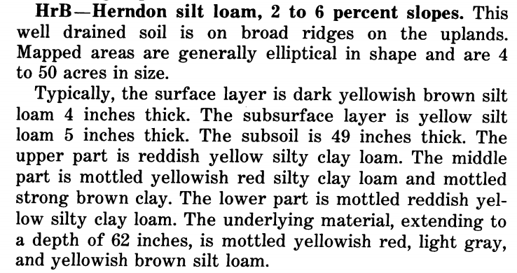
After Googling combinations of "HrB soil Orange County NC," we came across a PDF document that was a soil survey for the entire county. It had every soil from our county listed and describes each one. We found that HrB is "Herndon silt loam with 2 to 6 percent slopes." More importantly, as you can see below, it describes its potential for supporting urban use/septic use.
While it can take a little while to get a hang of the GIS and it may take some time to find out what each soil type means (if that's what you're using the GIS for), we found that it was a useful tool for helping us avoid hour-long trips to visit land that wouldn't support our dream anyways. Even if you've already found land, it's also useful to know the soil type before hiring a soil engineer. If the soil is clearly bad, you can, at the very least, expect to increase your budget for the septic system you might need. Worst case, you might decide to look elsewhere, but at least you saved on hiring an engineer.
While we primarily used the GIS for soil, as we progressed in our land search, we evolved our usage a bit to include a couple more parameters. You can see things like nearby well depth (this helped us guess at how deep our well would need to be, and budget accordingly), contours (which, as we mentioned, helped us place our house towards the highest point on the property), zoning information (agricultural, residential, commercial, etc. - this can help you figure out if what you're trying to build is even possible in the area you're looking), school system boundaries, and so much more.
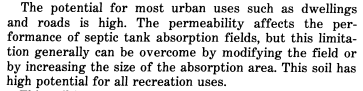
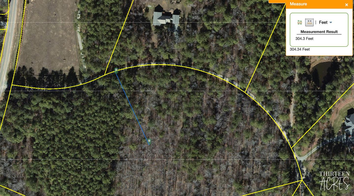
One thing we also found useful with the GIS was the ability to measure area and distances. Google Maps has some similar functionality, but with the GIS making additional layers available that Google Maps doesn't have, it was nice to have it all in one area.
There are many tools you can use to help you find property, and we found that the GIS was a very valuable tool for helping us to determine which property was right for us. While we ultimately paid to have a soil test done on our property, even with two permits in place and the soil being pretty stable for a septic system, we still found it valuable to filter out properties before visiting them. It also did make us feel better putting an offer in on this property and fairly confident that the soil engineer would just confirm what we already knew. You can do so much with the GIS, we're sure we didn't end up discovering every cool thing it can do, but we hope that introducing you to the possibilities makes your search even a tiny bit easier!
If you've had any experience using the GIS and have any other tips, please let us know in the comments!
Comments